
Strengthening Geospatial Data Ecosystems
The Umbrella Fund for Geospatial Interventions
The Umbrella Fund’s Geospatial Interventions portfolio is the first thematic investment portfolio launched under the Fund. It focuses on strengthening how geospatial data is generated, managed, and applied to improve public health planning and service delivery across low- and middle-income countries.
Download VP Report - Nigeria

Download VP Report - DRC

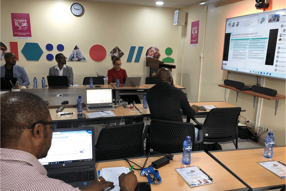
Across both countries, the assessments demonstrated that stronger geospatial systems can significantly improve the planning, targeting, and delivery of health services. These findings informed the Fund’s initial investment priorities and continue to guide implementation and learning.
The portfolio was developed in response to findings from Geospatial Value Pipeline Assessments conducted in Nigeria and the Democratic Republic of Congo, complemented by sub-national capacity assessments that identified critical gaps in institutional capacity, data governance, and operational use.
Why Geospatial for Health?
Better data, better decisions, better reach
Effective public health systems depend on knowing where people live, where services are available, and where critical gaps remain. Geospatial data provides this insight, enabling governments and development partners to make better decisions, allocate resources more effectively, and improve service delivery.
Within the health sector, stronger geospatial systemes contribute to:
Improving maternal, newborn, and child health outcomes.
Strengthening immunization planning and vaccination coverage.
Identifying underserved populations and communities with limited access to services.
Supporting timely disease surveillance, outbreak preparedness, and emergency response.
Investment Areas
The Umbrella Fund’s investment priorities are informed by comprehensive Geospatial Value Pipeline and Capacity Assessments conducted across Nigeria and the Democratic Republic of Congo. These assessments identified four strategic investment areas that address critical gaps while strengthening national geospatial ecosystems.

Geospatial Capacity Institutionalization
Embed validated geospatial and health data curricula within accredited academic and government institutions.
Integrated Data Governance
Establish framework, standards and coordination structures across programmes and agencies
Subnational Geospatial Infrastructure
Stand up states and district-level data systems, portals and repositories with local ownership.
Country Footprint
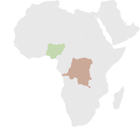
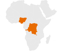
Since launching in 2024, the Umbrella Fund has initiated geospatial investments across Nigeria and the Democratic Republic of Congo through partnerships with governments, local institutions, academic organizations, and technical stakeholders.

Nigeria
Working across priority states including Anambra, Borno, Niger, Kebbi, FCT, and Kano to strengthen geospatial capacity, support state Primary Health Care Development Agencies, and collaborate with universities and technical institutions to improve health planning and service delivery.

Democratic Republic of Congo
Working across more than thirteen priority provinces in partnership with ANICNS, provincial health divisions, universities, and other national stakeholders to strengthen geospatial systems, institutional capacity, and evidence based decision making.
What’s Next?
The Umbrella Fund will continue to generate learning from its geospatial investments to inform future funding priorities and expand its portfolio into additional sectors where locally led solutions can strengthen systems and improve development outcomes.
Join our mailing list to receive updates on funding opportunities, technical resources, publications, and upcoming events.
Enter your email
Join the Mailing List


Strengthening Geospatial Data Ecosystems
The Umbrella Fund for
Geospatial Interventions
The Umbrella Fund's Geospatial Interventions portfolio is the first thematic investment portfolio launched under the Fund. It focuses on strengthening how geospatial data is generated, managed, and applied to improve public health planning and service delivery across low- and middle-income countries.
The portfolio was developed in response to findings from Geospatial Value Pipeline Assessments conducted in Nigeria and the Democratic Republic of Congo, complemented by sub-national capacity assessments that identified critical gaps in institutional capacity, data governance, and operational use.
Across both countries, the assessments demonstrated that stronger geospatial systems can significantly improve the planning, targeting, and delivery of health services. These findings informed the Fund's initial investment priorities and continue to guide implementation and learning.
Download VP Report - Nigeria
Download VP Report - DRC
Strengthening Geospatial Data Ecosystems
The Umbrella Fund for
Geospatial Interventions
The Umbrella Fund’s Geospatial Interventions portfolio is the first thematic investment portfolio launched under the Fund. It focuses on strengthening how geospatial data is generated, managed, and applied to improve public health planning and service delivery across low- and middle-income countries.
The portfolio was developed in response to findings from Geospatial Value Pipeline Assessments conducted in Nigeria and the Democratic Republic of Congo, complemented by sub-national capacity assessments that identified critical gaps in institutional capacity, data governance, and operational use.
Across both countries, the assessments demonstrated that stronger geospatial systems can significantly improve the planning, targeting, and delivery of health services. These findings informed the Fund’s initial investment priorities and continue to guide implementation and learning.
Download VP Report - Nigeria
Download VP Report - DRC
Why Geospatial Health?
Geospatial data helps decision-makers understand where gaps in coverage exist, where to allocate resources, and how to deliver services more efficiently.
Improving maternal, newborn, and child health outcomes.
Strengthening immunization planning and vaccination coverage.
Identifying underserved populations and communities with limited access to services.
Better data, better decisions, better reach
Effective public health systems depend on knowing where people live, where services are available, and where critical gaps remain. Geospatial data provides this insight, enabling governments and development partners to make better decisions, allocate resources more effectively, and improve service delivery.
Supporting timely disease surveillance, outbreak preparedness, and emergency response.
Our Four-Pillar Approach
The Umbrella Fund's geospatial investment portfolio is built around four complementary pillars that strengthen national geospatial ecosystems while supporting long term institutional capacity and locally led implementation.
The Fund’s geospatial intervention is structured around four core pillars. These guide the design, funding, and support of all activities.
Identifying Data Gaps & Investment Opportunities
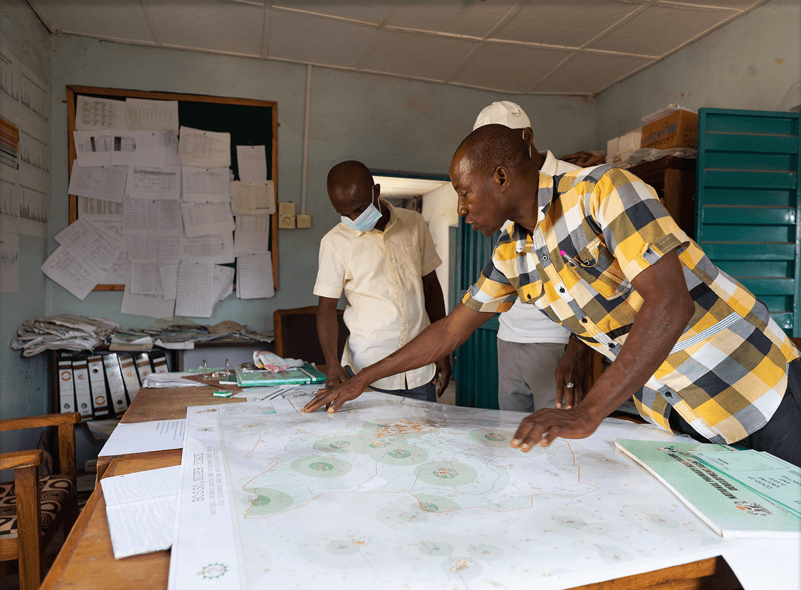
Working with governments, academic institutions, civil society, and technical partners, the Fund identifies critical gaps in geospatial data systems and prioritizes investment opportunities that strengthen national capacity and improve development outcomes.
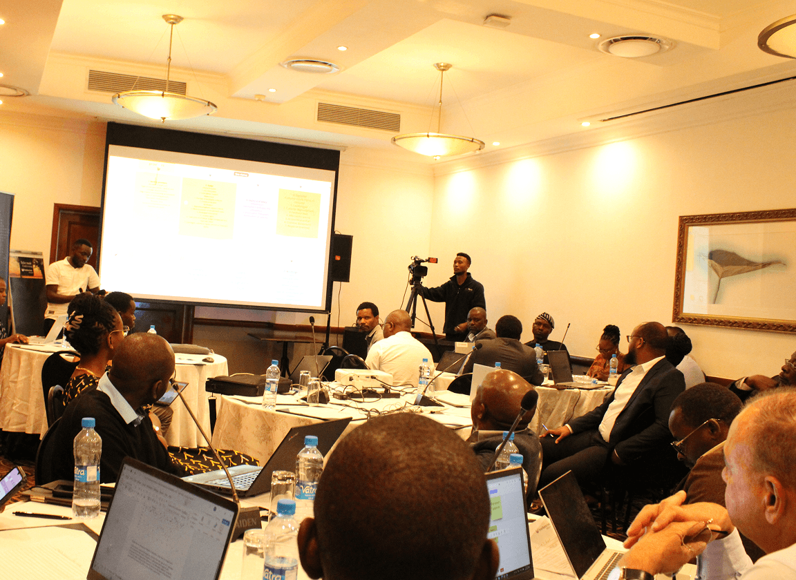
Cross-Sector Collaboration & Partnership Development
The Fund brings together governments, development partners, academic institutions, and local organizations to strengthen coordination, encourage knowledge exchange, and develop partnerships that support sustainable geospatial ecosystems.

Funding & Technical Assistance
The Fund combines catalytic grant funding with technical assistance to help local organizations strengthen institutional capacity, integrate geospatial tools into decision making, and scale solutions that align with national priorities and local needs.

Partnerships & Knowledge Exchange
Beyond funding, the Fund supports learning, collaboration, and the exchange of technical knowledge across institutions and countries. This helps strengthen geospatial governance, improve policy implementation, and build sustainable capacity that extends beyond individual investments.
Investment Areas
The Umbrella Fund's investment priorities are informed by comprehensive Geospatial Value Pipeline and Capacity Assessments conducted across Nigeria and the Democratic Republic of Congo. These assessments identified four strategic investment areas that address critical gaps while strengthening national geospatial ecosystems.
Geospatial Capacity Institutionalization
Embed validated geospatial and health data curricula within accredited academic and government institutions.
Geospatial Capacity Institutionalization
Integrated Data Governance
Establish framework, standards and coordination structures across programmes and agencies
Subnational Geospatial Infrastructure
Stand up states and district-level data systems, portals and repositories with local ownership.
Geospatial Policy Operationalization
Turn national geospatial policies and architectures into routine funded practice.
Country Footprint
Since launching in 2024, the Umbrella Fund has initiated geospatial investments across Nigeria and the Democratic Republic of Congo through partnerships with governments, local institutions, academic organizations, and technical stakeholders.
Nigeria
Working across priority states including Anambra, Borno, Niger, Kebbi, FCT, and Kano to strengthen geospatial capacity, support state Primary Health Care Development Agencies, and collaborate with universities and technical institutions to improve health planning and service delivery.
DRC
Working across more than thirteen priority provinces in partnership with ANICNS, provincial health divisions, universities, and other national stakeholders to strengthen geospatial systems, institutional capacity, and evidence based decision making.
The Umbrella Fund will continue to generate learning from its geospatial investments to inform future funding priorities and expand its portfolio into additional sectors where locally led solutions can strengthen systems and improve development outcomes.
Join our mailing list to receive updates on funding opportunities, technical resources, publications, and upcoming events.
What’s Next?
Enter your email
Join the Mailing List
Country Footprint
Since launching in 2024, the Umbrella Fund has initiated geospatial investments across Nigeria and the Democratic Republic of Congo through partnerships with governments, local institutions, academic organizations, and technical stakeholders.
Nigeria
Working across priority states including Anambra, Borno, Niger, Kebbi, FCT, and Kano to strengthen geospatial capacity, support state Primary Health Care Development Agencies, and collaborate with universities and technical institutions to improve health planning and service delivery.
DRC
Working across more than thirteen priority provinces in partnership with ANICNS, provincial health divisions, universities, and other national stakeholders to strengthen geospatial systems, institutional capacity, and evidence based decision making.
The Umbrella Fund will continue to generate learning from its geospatial investments to inform future funding priorities and expand its portfolio into additional sectors where locally led solutions can strengthen systems and improve development outcomes.
Join our mailing list to receive updates on funding opportunities, technical resources, publications, and upcoming events.
What’s Next?
Enter your email
Join the Mailing List
Country Footprint
Since launching in 2024, the Umbrella Fund has initiated geospatial investments across Nigeria and the Democratic Republic of Congo through partnerships with governments, local institutions, academic organizations, and technical stakeholders.
Nigeria
Working across priority states including Anambra, Borno, Niger, Kebbi, FCT, and Kano to strengthen geospatial capacity, support state Primary Health Care Development Agencies, and collaborate with universities and technical institutions to improve health planning and service delivery.
DRC
Working across more than thirteen priority provinces in partnership with ANICNS, provincial health divisions, universities, and other national stakeholders to strengthen geospatial systems, institutional capacity, and evidence based decision making.
Working across more than thirteen priority provinces in partnership with ANICNS, provincial health divisions, universities, and other national stakeholders to strengthen geospatial systems, institutional capacity, and evidence based decision making.
Country Footprint
Since launching in 2024, the Fund has initiated work across multiple regions:
Nigeria
Working across priority states including Anambra, Borno, Niger, and Kano
Collaborating with state PHCDAs, and academic institutions
DRC
Engaging 13+ priority provinces.
Partnering with ANICNS, provincial health divisions, and universities.
Our Four-Pillar Approach
The Umbrella Fund’s geospatial investment portfolio is built around four complementary pillars that strengthen national geospatial ecosystems while supporting long term institutional capacity and locally led implementation.
Identifying Data Gaps & Investment Opportunities
Working with governments, academic institutions, civil society, and technical partners, the Fund identifies critical gaps in geospatial data systems and prioritizes investment opportunities that strengthen national capacity and improve development outcomes.
Cross-Sector Collaboration & Partnership Development
Funding & Technical Assistance
Partnerships & Knowledge Exchange
